Weather forecasts and predictions can be found online like sand by the sea. Weather forecasts calculated down to the hour from all corners of the earth can be viewed free of charge - this suggests a dangerous feeling of predictability and reliability.
At the same time, the actual formation mechanisms of wind and thermals are increasingly being forgotten. With so much data available, it is more important than ever to correctly assess the information and draw the right conclusions. Observing the local weather situation is often more informative and accurate than computer algorithms. The following five basic principles have a decisive influence on the formation of the wind. We reveal the best way to react on the water.
We also analysed wind and weather providers for accuracy. The results as a PDF download
If you want to find out more about wind, clouds and the formation of fronts, the DK-Shop find what you are looking for. The experts at Wetterwelt produce a detailed forecast for the Baltic Sea region every week in the Sailing weather for the weekend.
Temperature and pressure
The energy of the solar radiation on the earth's surface varies from place to place - for example due to the angle of the solar radiation, the time of year, a mountain formation or different reflections on the earth's surface. Air is therefore heated to different degrees.
Warm air expands, becomes lighter and eventually rises, a physical law. Where this ascending air once was, an area with less air pressure develops, a heat low. This explains the low-pressure areas over the Western Sahara and near the equator.
The land-sea wind system
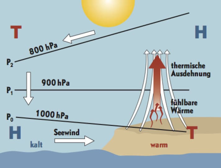
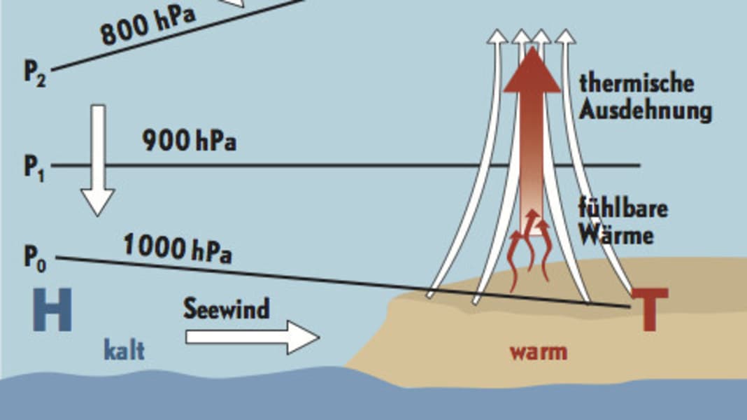
On a smaller scale, this happens on every coast, provided the sun is shining. The colder temperature of the water also increases the air pressure above the sea surface. The noticeable result of these pressure differences is an onshore wind. At night, when the land cools down quickly but the water temperature remains constant, the effect is reversed: the wind blows offshore. From a temperature difference of eight degrees Celsius between water and land, this circulation begins, a result of thermals.
The Coriolis force
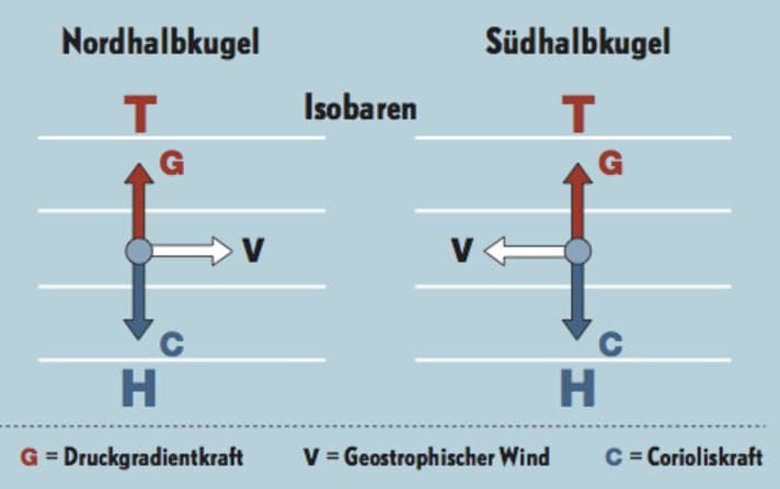
If pressure differences were quickly equalised by a direct flow of air from high to low, wind forecasts would be child's play. Of central importance is theCoriolis force to. It deflects air currents to the right in the northern hemisphere and to the left in the southern hemisphere. It acts on all particles moving over the earth's surface. If the air molecules move very quickly, the Coriolis force also has a stronger effect. It is proportional to the speed of the particles.
Due to these two influences, the air molecules change their trajectory and finally move along lines of equal pressure, theIsobars.
This does not yet have much to do with reality, because other influences come into play here ...
Friction
We still assume that air masses move from A to B, influenced solely by the Coriolis force. But on the way there, the air is slowed down by friction on land and water surfaces. The effect weakens with increasing altitude. The difference in wind force and direction as a function of altitude is known as the gradient.
Gradient
This means that a stronger breeze blows at the masthead than directly on the water. Sailors are familiar with this phenomenon: the anemometer at high altitude sometimes shows a completely different wind speed and direction than the one that can be felt and measured in the cockpit. So appearances need not be deceptive here. Accordingly, the Coriolis force has a weaker effect on the slower air near the ground than on the faster air at altitude.
All forecasts and measured values must be interpreted against this background. If the measuring station is 40 metres above sea level, the wind on the water can deviate significantly in some cases. Ideally, you should know the exact position of the relevant stations for the area and adjust the data accordingly.
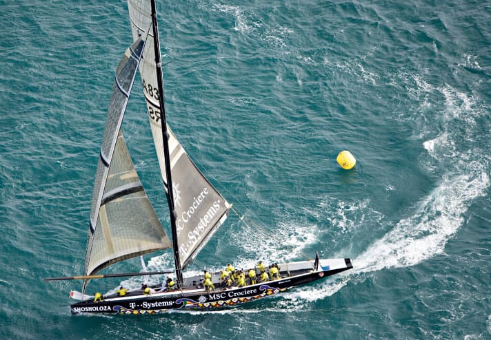
The gradient is also important for the trim, as it indicates that the wind is coming in with different strengths in different areas of the sail. This can be reacted to with the "twist", the rotation within the sail. At a height of a few metres, the apparent wind is already stronger and more aft than on the lower leech - accordingly, the sail must be more open in the top area. Due to the cut, such a position is usually achieved automatically, especially with headsails.
Stability
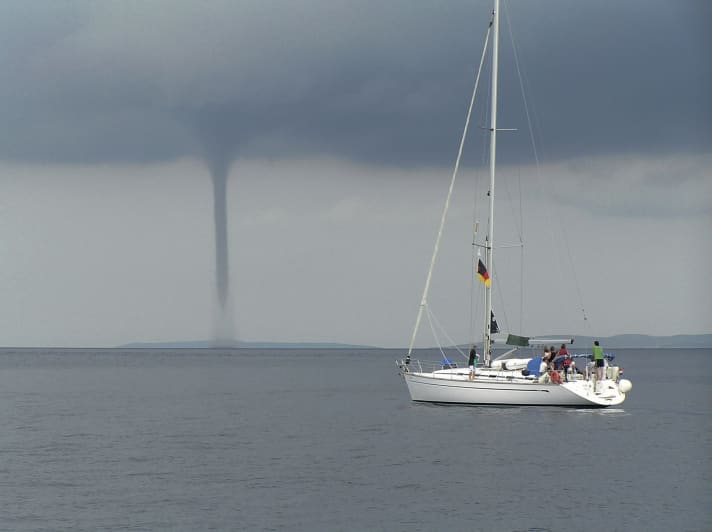
Vertical air movements are fundamental to understanding wind and thermals. This also includes the rising of air from the water or land surface mentioned at the beginning. Thermals themselves are withoutTurbulencethe vertical rise of air masses, would be inconceivable. This is particularly evident in the case of waterspouts. They occur when the water is so warm that the air rises vertically at high speed. On the other hand, there is great stability when the water is particularly cold. A stable layer of air then forms above the surface and there is little mixing with the layers above. The air wants to remain at its altitude. This further intensifies regional wind effects such as the chapel effect.
